
Walk a Richmond Street by Address
A Richmond street directory search works best when each source answers one narrow question. The Madison County Property Valuation Administrator, or PVA, identifies the assessed parcel and current ownership data. County GIS places it among nearby lots. The County Clerk connects named parties through deeds, mortgages, and plats. Voter records and dated directories can add evidence of presence, but neither is a full household list. Keep the source date beside every name. An assessed owner may live elsewhere, and a subscriber may have moved after a book was printed.
- Enter the house number and street in the Madison parcel viewer. Copy the PIN, tax year, and situs address exactly.
- Open the map and inspect adjoining lots. Record parcel identifiers before names.
- Separate the owner's mailing address from the physical, or situs, address.
- Search both grantor and grantee sides of the clerk index. Follow prior deed book and page references.
- Test lawful voter information and dated telephone or reverse directories for evidence tied to the same date.
This sequence produces a record trail, not a claim about every person at the property. When the goal shifts to one named person, use the Richmond resident lookup and verify identity across separate records.
Richmond Parcel Search Fields
The official Madison County parcel viewer offers attribute and shape searches. Its screen accepts a parcel number, PIN, property address, or subdivision. Address and parcel searches require at least three characters, while a PIN can begin with one. Results show PIN, tax year, and property address. Map panels include county data, contours, 2023 imagery, measurement, print, street view, and markup.
| Search field | Input | Minimum | Best use |
|---|---|---|---|
| Parcel Number | Text | 3 characters | Tax parcel match |
| PIN | Text | 1 character | Stable follow-up key |
| Property Address | Text | 3 characters | Situs and parcel row |
| Subdivision | Text | 3 characters | Grouped parcel results |
Check the live Madison parcel tool before relying on the interface pictured below.
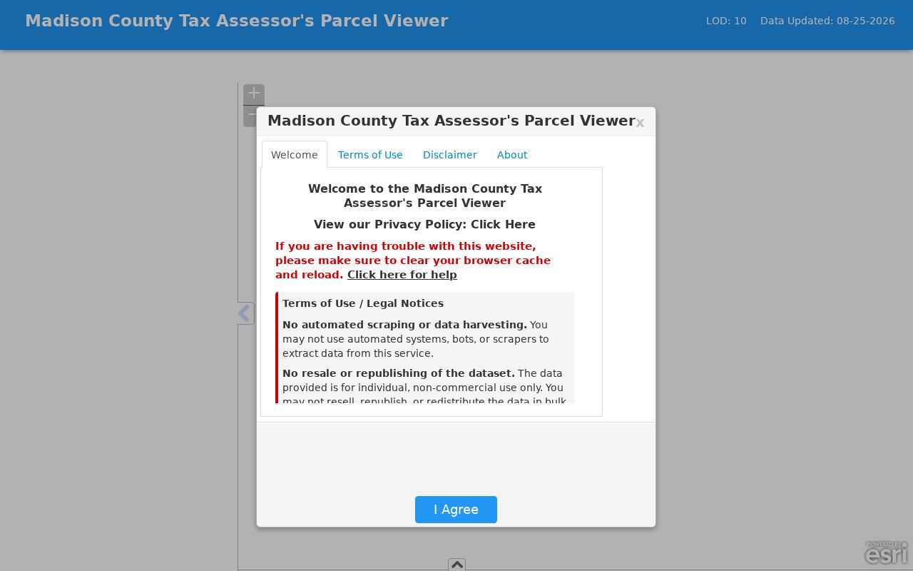
The image confirms the address, PIN, parcel, and subdivision routes. Current county data remains the source of record.
Richmond Street Record Terms
Several labels recur when an address moves from map to deed. Copy them carefully because each points to a different part of the Richmond street directory trail.
- Parcel
- A mapped unit of land used for assessment and record linkage, not a household.
- Situs address
- The physical property location, which may differ from an owner's mailing address.
- Plat
- A recorded drawing of lots, boundaries, roads, and subdivision details.
- Criss-cross directory
- A directory arranged by street or address rather than only by surname.
A PIN often survives formatting changes better than a typed street name. Save it before moving among PVA, GIS, and deed systems.
Richmond Records Indexed by Address
No public Richmond street directory contains a full current roll of occupants. Address-keyed records overlap instead. PVA and GIS form the broad county layer. Clerk deeds and plats add title history. City permits and code files apply only within Richmond's boundary. Kentucky's public Voter Information Center requires first name, last name, and date of birth. It answers a voter-specific query rather than publishing a street roster.
| Source | Keeper | Address evidence | Access |
|---|---|---|---|
| Parcel assessment | Madison County PVA | Owner, situs, mailing, PIN, value | Free basic search |
| Parcel map | County and city GIS | Geometry, nearby parcels, imagery | Public map hubs |
| Deed, mortgage, plat | Madison County Clerk | Parties, legal description, book/page | Office and eCCLIX |
| Permit or code case | Richmond departments | Project and property links | Accela or records request |
| Historical directory | Libraries and archives | Dated subscriber or address lead | Digital item or staff help |
Purpose matters. PVA assesses property; it does not certify occupancy. A deed proves a transaction or interest, not who lived there later. The free PVA search supplies ownership and value. Subscription access, when available, can add transfer history, sales, photographs, improvement traits, class, and tax information. A four-year review cycle is not an occupancy check.
Richmond Streets in Clerk Deeds
The Madison County Clerk Recording Department keeps deeds, mortgages, plats, wills, and other documents at 321 N Madison Avenue. Its genealogy inventory reports deeds from 1786 to the present and plats from 1800 to the present. The recording page says records are searchable by a person's name only. That makes the parcel-to-owner step vital before using the clerk index.
Online access uses eCCLIX and requires an account. Search both grantor, the party transferring an interest, and grantee, the party receiving it. Follow earlier book and page references, comparing legal descriptions, subdivisions, lots, and boundaries. The clerk counter is the fallback for help and certified copies. Kentucky Department for Libraries and Archives accepts requests for appropriate older holdings and gives a four-to-six-week estimate.
The clerk's genealogy inventory adds several address clues beyond ordinary deeds. Allotments of dower and wills begin in 1786, while court orders also reach back to that year. A widow, heir, estate, commissioner, or sheriff may appear in an index where the expected owner does not. Preserve that role beside the name. The Kentucky deed-research guide explains index letters such as H for heirs, C for commissioner, and S for sheriff. It also warns that research before 1890 may need tax records because older indexing and context differ. If an eCCLIX query produces no useful row, take the current PIN, owner variant, legal description, and any cited book and page to the clerk counter. Ask whether the needed volume is onsite, available through a terminal, or held through Kentucky Department for Libraries and Archives.
Search tip. Record each party, book, page, date, and legal description before opening the prior link in the deed chain.
Richmond City Limits Change Routing
A Richmond mailing label does not always place a parcel inside the city. Madison County PVA and GIS cover county parcel context. Richmond Planning and city GIS show municipal layers. Building Inspections says it does not inspect outside Richmond city limits or in Berea. Check the boundary before asking for permits, inspections, or code cases.
Start with the parcel and taxing district, then consult the city layer. If the property falls outside Richmond, route the request to the right custodian. An empty city search does not prove the record is absent. County GIS says its maps are continuously updated, so note the viewing date.
For a property within Richmond, the city Building Inspections and Planning lanes may produce permit, inspection, development-review, zoning, or code records tied to the address. Accela Citizen Access is the named permit route, but the research encountered an access barrier and did not establish the archive's first year. Use the city open-records process when the public screen fails. Describe the existing record sought, the exact address, a reasonable date span, and the department likely to hold it. Richmond's open-records instructions state that the city makes its determination within five business days. A request should seek an existing permit, file, map, or case rather than ask staff to create a new street roster.
Richmond Streets Before Parcel IDs
The November 1886 Richmond Sanborn map has three sheets and predates modern parcel identifiers. It can locate a street segment, footprint, or use. It cannot prove title or name all residents. Pair a mapped shape with clerk plats and deeds, then compare it with current PVA geometry.
Madison County formed in 1785, and Richmond became its county seat in 1798. Early deeds may use landmarks, courses, adjoining owners, or the courthouse and market rather than a current number. Richmond's marketplace began in 1810, gained a market house in 1812, and lost it in 1852. Such facts explain why old wording may not fit a modern search box.
Historical voter registers add another dated layer. A Kentucky collection covers 1904 through 1935 and includes Madison County. Copy the precinct and address as written. The 1950 census can supply household relationships, but name recognition and street indexing are imperfect. Inspect the image and compare its street sequence with maps.
Eastern Kentucky University supplies another local bridge through its Madison County Commissioners Deeds collection. The digitized series spans 1791 through 1979 and contains 784 scanned items, but the repository calls it incomplete. A commissioner deed can reveal heirs, a court-directed transfer, or an older legal description that does not surface under the expected owner. Search the collection as supporting evidence, then return to the County Clerk for the official chain and any certified copy. Keep the EKU item title, date, image number, and repository URL in the same note as the modern parcel PIN. That pairing makes an old street description easier to compare with current geometry without claiming the scan represents the whole deed record.
A Dated Richmond Street Snapshot
Richmond's telephone system began in 1879 and is described by the Historical Society as Kentucky's first outside Louisville. The verified Southern Bell volume dated March 14, 1966 has 70 pages covering Richmond, Ford, Kirksville, Waco, Berea, and Paint Lick.
Read the Historical Society's account of Richmond places before using the capture below.
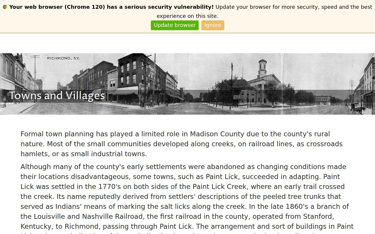
The local history gives context for the subscriber book, which is a dated address snapshot, not a census. For the historical shelf, consult the Richmond Directory Book page.
Normalize Richmond Street Addresses
USPS, PVA, deeds, plats, city directories, and Sanborn sheets can spell one Richmond location differently. Preserve the source form first. Then test standard directionals, suffixes, spacing, and postal city. Never silently replace a rural route, crossroads name, or older place label.
Use the official USPS lookup to check current postal wording.
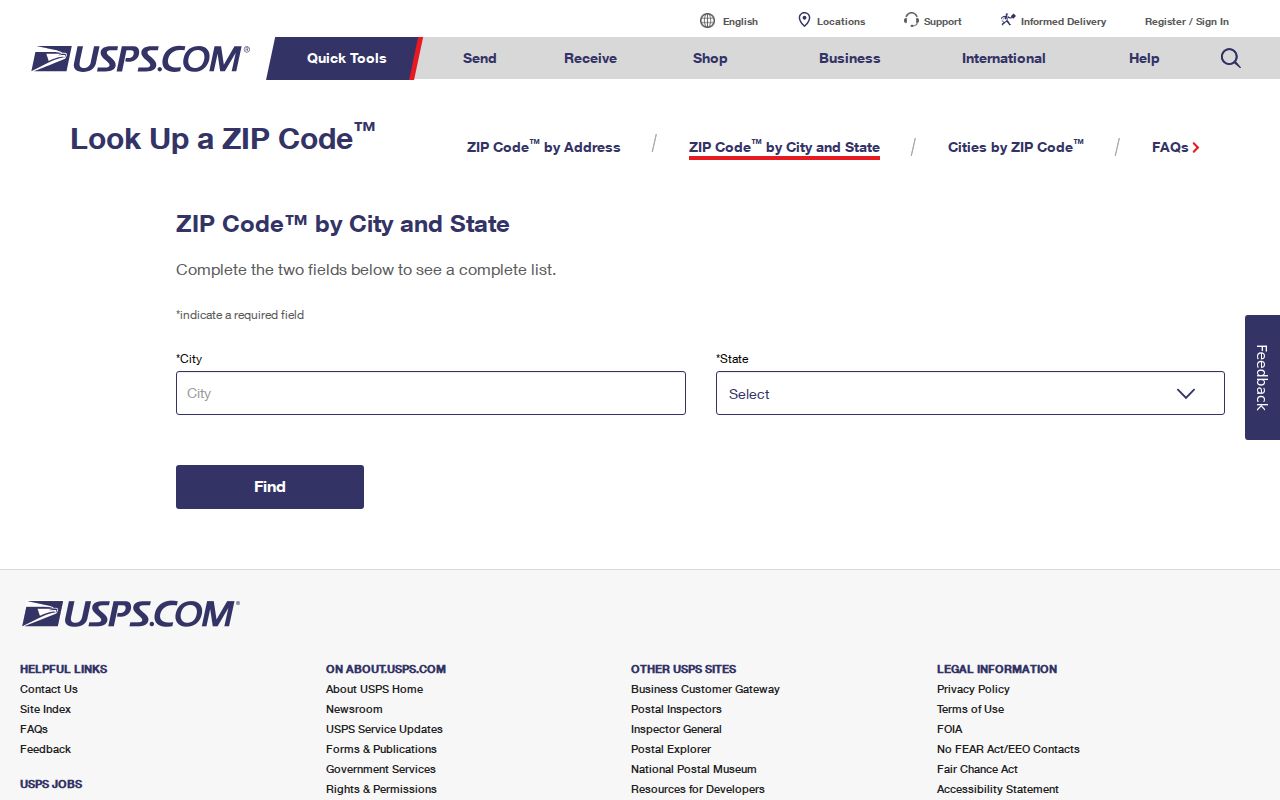
USPS confirms delivery conventions, not city limits, title, or occupancy. Compare its result with PVA situs data and municipal boundaries.
Richmond has two ZIP labels documented in a Kentucky public-service record based on USPS descriptions: 40475 as the standard lane and 40476 as a post-office-box lane. Use the current USPS tool for a live answer because the cited table is dated. A box number cannot be plotted as a parcel, and a standard ZIP still covers postal geography rather than an incorporated boundary. When a directory entry supplies only a box, move to the subscriber name, dated publication, deed index, or other lawful source instead of assigning the box to a street lot. Keep both the postal result date and the parcel-search date in the research notes.
Richmond Postal Address Check
The Richmond Post Office listing supplies a second official postal check when a typed address or city label is uncertain. It helps confirm the servicing location before testing the same string in county databases.
Check the official Richmond Post Office listing before using the captured page.
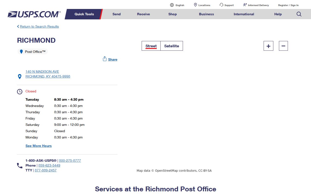
The post-office page confirms the postal source, while parcel and municipal systems still decide situs and jurisdiction.
Address normalization should remain reversible. Save the original house number, directional, suffix, rural route, apartment line, and community label in one column, then place the tested USPS form in another. If no parcel appears, try the original wording, a shortened suffix, the subdivision field, and the map itself. Record each failed variant. This avoids the common mistake of turning a portal's spelling preference into a claim that an older Richmond address never existed.
Limits of Richmond Street Records
A street directory cannot prove a complete current household. Parcel systems focus on assessment and ownership. Deeds document land interests. The Voter Information Center answers a voter-specific query, not a street list. Kentucky Safe at Home may withhold an eligible participant's address.
Log the portal, date, exact field, address form, and filters. Say a record was not located, not that it does not exist. The clerk counter, PVA office, GIS staff, city records route, library, or archives may hold a source the web interface does not expose.
Lawful use. Use Richmond address records only for lawful personal research. Never use them to stalk, harass, threaten, or harm anyone.