
Richmond ZIP Directory Coverage
Official materials support two Richmond ZIP code entries with different functions. The Kentucky Public Service Commission hosts a dated USPS description table that identifies one standard-delivery code and one PO-box code for Richmond in Madison County. The current USPS lookup remains the final check for a live address because the table dates from 2012. No reviewed official source showed 40477 serving Richmond, so it should not be added without a current address-level result.
| ZIP | Area or Use | Post Office | Boundary Note |
|---|---|---|---|
| 40475 | Standard street delivery for Richmond-area addresses | Richmond Post Office | Postal Richmond alone does not establish city limits |
| 40476 | Richmond PO boxes and correspondence | Richmond Post Office | A mailbox does not identify a physical parcel |
The Richmond Post Office is at 140 N Madison Avenue, Richmond KY 40475-9998. Its local number is 859-623-5449, and the main USPS number is 1-800-ASK-USPS. These details identify the postal facility, not the boundaries of either ZIP. Berea and other Madison County communities may appear in nearby research, but no non-Richmond ZIP belongs in this Richmond ZIP code directory unless USPS confirms it for the exact address.
Search Richmond ZIP Fields
The USPS ZIP Code Lookup offers three useful modes. By Address is the right choice for a known building. By City and State returns a complete postal list for the entered city. Cities by ZIP Code returns recommended city names for a code. USPS also warns that its result does not confirm a person or company is present at an address.
| USPS Mode | Required Input | Best Richmond Use |
|---|---|---|
| By Address | Street, city, state; unit when needed | Normalize one physical address and obtain its current ZIP |
| By City and State | City and state | Check the current set of ZIP codes USPS assigns to Richmond |
| Cities by ZIP | ZIP code | Confirm recommended postal city names |
| Company | Optional in address mode | Clarify a business delivery point without proving occupancy |
| Apt, Suite, Other | As applicable | Preserve unit detail when USPS requires it |
The captured USPS city-and-state search shows the official starting screen used for Richmond postal verification.
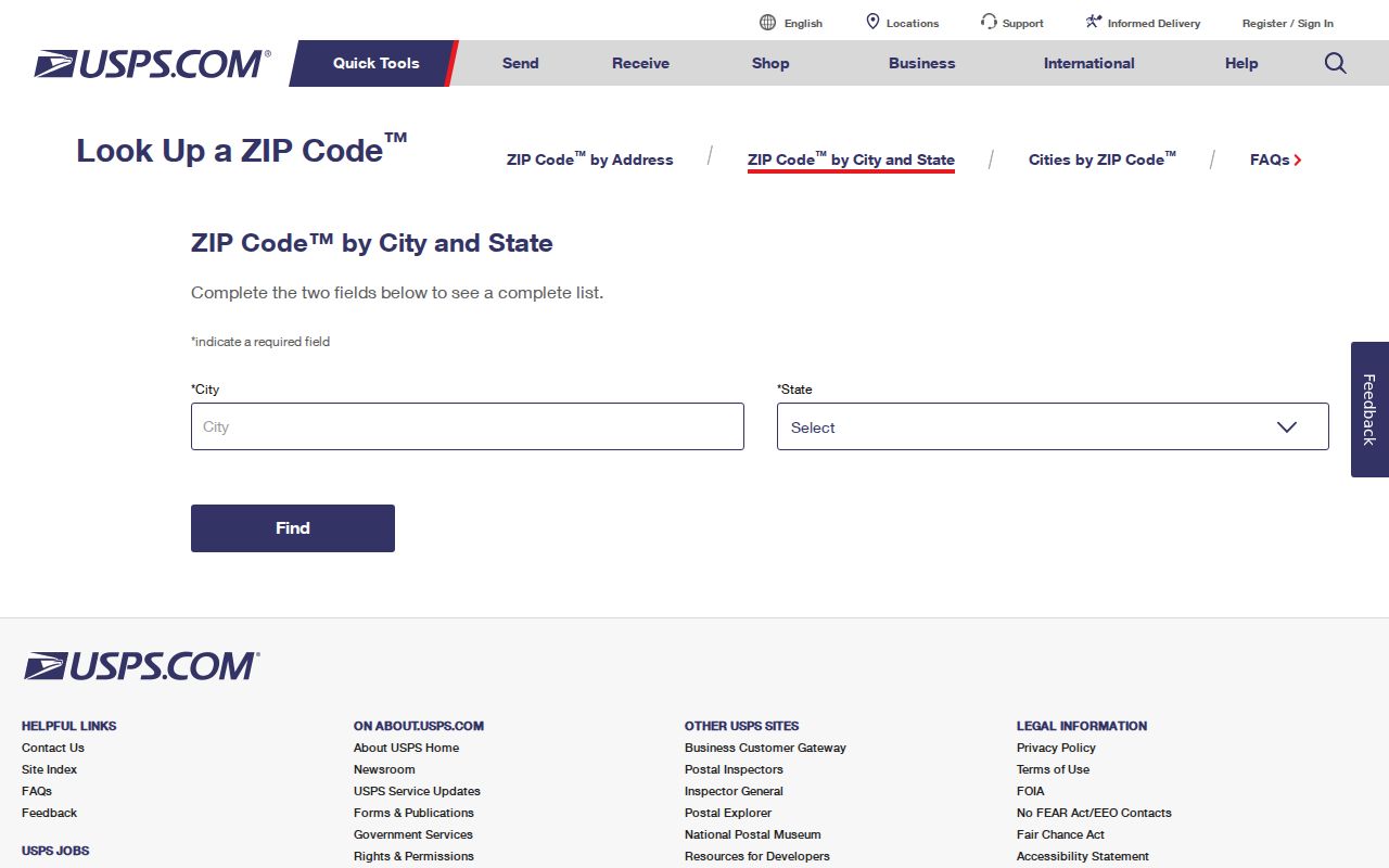
That search narrows postal codes, while a separate parcel or city map decides which government office has the next record.
Find Richmond Residents by ZIP
No official portal reviewed offers a free public roster of residents by Richmond ZIP code. The public PVA/ISV screen accepts a parcel number, PIN, address, or subdivision, but no verified ZIP filter appeared. The Kentucky Voter Information Center requires a legal first name, last name, and birth date for one person. It has no public ZIP-wide browse. ZIP code research therefore works as a narrowing process, not a bulk people list.
- Enter the full address in USPS. Save the recommended street form, postal city, ZIP, and the date checked.
- Use that street address in the Madison County PVA or parcel viewer. Record the parcel or PIN, situs address, tax district, and owner field without confusing mailing and physical addresses.
- Compare the parcel with city or county GIS. Decide whether Richmond city, Madison County, or another municipal custodian holds the desired record.
- Run a person-specific official search only when the needed identifying fields and a lawful purpose are available. Preserve the record date and limits.
Once a ZIP narrows the area to a named road, the Richmond street directory explains the address-to-parcel method in full. That page owns street-level searching; the ZIP code directory keeps the postal and boundary questions in focus.
Richmond Postal and Parcel Labels
A record may show “Richmond, KY 40475” while the parcel sits outside the incorporated city. Preserve the label as printed, then verify the parcel. The Madison County PVA and ISV parcel viewer distinguish the situs address, which is the physical parcel location, from an owner's mailing address. County GIS supports E-911 and countywide geometry. Richmond Planning and city GIS handle municipal boundary, planning, and zoning context.
The order matters: postal result, parcel, city boundary or tax district, then custodian. A postal label routes mail. A parcel identifies land. A city limit decides whether a Richmond municipal department may hold a permit or code file. A voting precinct serves election administration. None can safely stand in for the others.
| Source Label | Keep It As | Next Check |
|---|---|---|
| Richmond, KY 40475 | Postal city and ZIP | USPS, then city or county boundary |
| Richmond, KY 40476 | PO-box mailing address | Do not map it to a home |
| Owner mailing address | Mail destination | Compare with parcel situs |
| Parcel situs | Physical parcel address | PVA and map geometry |
| Voter residence | Dated registration field | County Clerk and privacy rules |
Richmond's PO Box ZIP
The 40476 entry is the clearest local ZIP quirk. The dated USPS description labels it PO BOX, while 40475 is STANDARD. A 40476 address can identify correspondence routed through the Richmond Post Office, but it cannot locate a building, subdivision, voter precinct, or household. Do not attach the mailbox code to a parcel simply because the box holder's name appears elsewhere.
This distinction is useful for estate files, business filings, and old correspondence. Preserve the box as a mailing fact and look for an independent situs address in a deed, parcel card, or official application that lawfully exposes one. If the question is current delivery, rerun the USPS lookup. The 2012 table supports the standard-versus-box distinction at that date, not a claim that no later routing change occurred.
Note: A PO-box ZIP narrows mail handling, not the location of a Richmond resident or property.
Richmond ZIP Voter Limits
Kentucky's free Voter Information Center checks one submitted voter. It requires legal first name, last name, and date of birth, with the final four Social Security digits optional. County, street, and ZIP are not visible public search controls. A result can show registration, polling place, and absentee status, but the Madison County Clerk says registration is not proof of present residence.
The State Board of Elections has a separate voter-data request for eligible candidates, party committees, public-question committees, or another requester who states an allowed statutory purpose. Its format can include ZIP and street-order output. The form carries an oath against commercial use and resale, a seven-to-ten-business-day processing estimate, and a minimum charge. This restricted route should not be described as a general Richmond ZIP code directory.
Privacy matters. Do not publish a full name, address, birth detail, and voting history bundle merely because a lawful inspection route exists.
Richmond ZIPs Versus City Limits
A ZIP boundary is built for mail delivery, not city government. Richmond is Madison County's seat, yet “Richmond” can mean an incorporated city address, a postal city, a wider county place, or an historical name. The research found no official edge-address table that maps every 40475 address to the city line. It also found no dated public ZIP boundary layer that should be treated as final. Exact addresses must be checked one at a time.
When USPS and parcel labels differ, retain both. Use the parcel tax district and GIS boundary to identify the custodian. Richmond Building Inspections serves the city limits, while the Madison County PVA and GIS cover the wider county parcel context. This geographic difference is why the same ZIP may lead to different permit, planning, or open-records offices.
- ZIP
- A five-digit USPS routing code for a delivery area.
- ZIP+4
- The base ZIP plus four digits that narrow a delivery segment; Richmond's complete ranges were not found in the reviewed sources.
- PO-box ZIP
- A code reserved here for mailboxes rather than street delivery.
- Unique ZIP
- A ZIP assigned to one large recipient; no official Richmond example was found.
- Carrier route
- A group of addresses served along one postal delivery route, not a neighborhood boundary.
Historic Richmond Address Clues
ZIP codes do not solve older Richmond addresses. The 1886 Sanborn sheets predate modern parcel IDs and ZIP routing, while a verified 1966 Southern Bell directory gives a dated subscriber and street clue. Compare the building footprint and street name with a recorded deed or plat, then connect that legal description to the current PVA parcel. If the number or name changed, keep the conflict instead of forcing a modern ZIP onto the old source.
This geography-first method can help family historians place a former household without claiming that every listed subscriber lived there. The 1966 telephone item also covers Ford, Kirksville, Waco, Berea, and Paint Lick, which reinforces why a title or mailing label must not blur distinct Madison County communities. Record the page, publisher, source year, and current parcel match separately.
Confirm a Richmond ZIP Match
Finish with an audit trail. Record the original address exactly as found, source year, USPS result, postal city and ZIP, PVA situs and tax district, city-limit result, parcel key, correct record custodian, and any conflict that remains. Keep leading zeros and punctuation in parcel numbers. If a GIS layer appears to show ZIP boundaries, note its layer name, source agency, and metadata date before relying on it.
For historical work, compare the source year with the reference year. A 2012 table can support what the Richmond ZIP code directory looked like at that time, but not an undocumented split or realignment. No official Richmond ZIP change year was found. Saying that the date is unknown is more accurate than inventing a local boundary story.